GIS & Environmental Science Portfolio
Featured Projects
Water Scarcity Analysis for EV Battery Materials
A comprehensive geospatial analysis conducted in partnership with Rivian Automotive, evaluating water resource impacts of mining operations for battery minerals.
This analysis was the cornerstone of my Master's Project at Duke University, focusing on the water-energy nexus within electric vehicle production. The project evaluated the water footprint of mineral extraction for EV batteries, identifying critical regions where mining operations intersect with water scarcity issues.
Key Components:
- Development of comprehensive water scarcity maps using ArcGIS Pro
- Creation of an interactive dashboard for visualizing high-risk mining operations on ArcGIS Online
- Analysis of water usage patterns across different mineral extraction processes
Fog Monitoring System
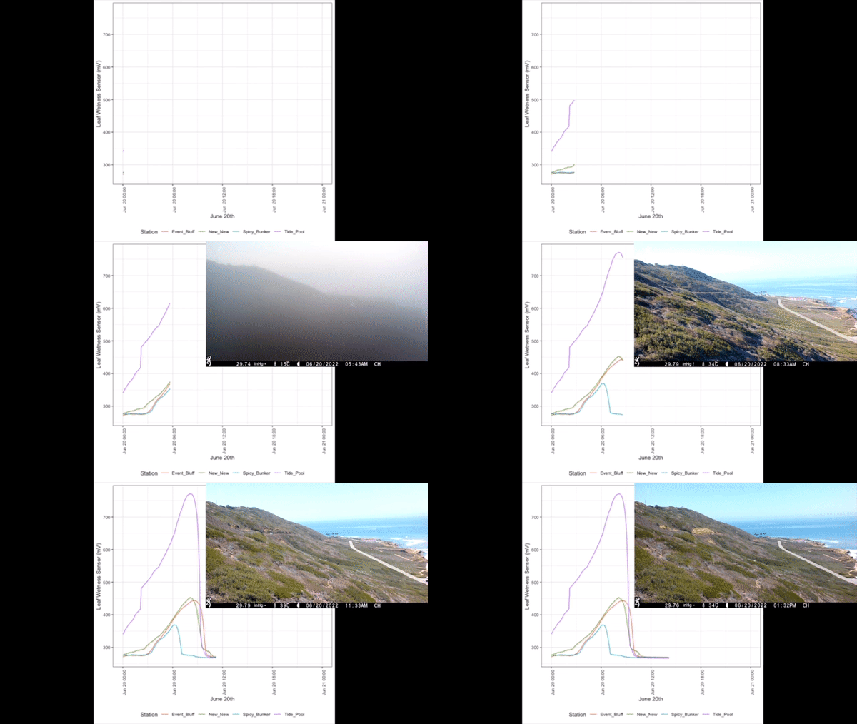
Innovative monitoring system to measure fog that coastal plant species need to thrive at Cabrillo National Monument.

This project developed an innovative fog monitoring system to track and measure fog patterns that are critical for the survival of coastal plant species at Cabrillo National Monument. The data gathered helps park managers understand hyper localized climate patterns and make informed conservation decisions.
NPS Article: Innovative System Measures Fog That Beloved Plants Need to Thrive
Fast Food Density in Waterville, Maine
Using spatial analysis techniques to investigate the urban legend of Waterville as the 'Fast Food Capital of the United States.'
This investigation began as a curiosity-driven project to verify a local urban legend in Waterville, Maine. Using geospatial analysis tools, I examined the density of fast food establishments relative to population size to determine if the town truly deserved its unofficial title as the "Fast Food Capital of the United States."
Technical Approach:
- Data collection and cleaning using Python in Jupyter Notebooks
- Spatial analysis of restaurant density patterns
- Population-based statistical comparisons with national averages
- Creation of an engaging, interactive narrative using ArcGIS StoryMaps
Technical Maps & Visualizations
Water Rights Transfer Analysis
Water rights transfer maps at John Day Fossil Beds National Monument showcasing advanced spatial analysis techniques and understanding of water transfer rights in Oregon.
Writing Samples
Professional Memorandum
Sample of technical writing skills and professional communication in water resource management context.